Convergence at Crookton
After leaving the Canyon Diablo bridge we meandered west along Interstate 40 towards Williams, Arizona. By this point it was late afternoon and the lighting was getting good. I was hoping to shoot at a location we discovered during our last trip to this area in 2006. It is a cool spot near Williams that affords a semblance of solitude and the railroad track alignment offers some great curves to accentuate the struggle trains face climbing the Arizona Divide. We dubbed this area “Scary Bear Road” because the area was remote and certainly seemed like bear country to us. (We have “friendly names” for many of our railfanning locations to help differentiate them and make them easier to remember.)
At one point along the way west we discovered that our camper’s refrigerator was not staying cold. I stopped at a truck stop to have a look at it. After opening the rear access paneling and disconnecting the camper’s battery, I saw the potential source of the failure. A 25-amp fuse was not only blown, it was also badly burnt. I went into the store at the truck and tried to find the requisite components to effect a repair. I found only 2 similiar sized fuses - a 20-amp and a 30-amp fuse.
I put the 20-amp fuses in place and reconnected the battery for a test. The fuse didn’t blow but the solder holding the end of the fuse to the glass tube melted and the fuse came apart! Bummer. Not being an electrician myself, I concluded, either rightly or wrongly, that was due to the resistance being generated by the corroded connector on the fuse holder. I used a brass brush to clean the contacts best I could and put in the 30-amp fuse. I tested it again. This time it seem to hold although I was concerned that I had used a bigger fuse than was required.
After running the refrigerator for a good 20 minutes or so to no adverse effect, I put Deb on “Smoke Duty” and asked her to watch the refrigerator access panel in her side mirror for signs of smoke as we headed west on Interstate 40 once again. I put a note on my to do list to stop somewhere and get the right fuse soon.
We eventually reached the official location of “Scary Bear Road,” which is off of Garland Prairie Road, east of Williams. As I rounded the curve and expected to find our turnoff I was sorely disappointed. Apparently in last years since we had been to this area, the US Forest Service had graded a road right through the heart of the “Scary Bear Road” area. Gone was the nondescript single-lane gravel road we knew. It was replaced my a wide and fully-graded dirt road.
We decided to give it a try nonetheless to see if we could locate our previous campsite. As we traveled down the road and tried to correlate our memories with the current surroundings, we were passed by multiple folks on quads or ATVs and many people hauling boats on trailers. It soon became apparent that this area was no longer affording a removed sense of remoteness but rather one of a busy rural route. I did not feel comfortable camping in the area so we, unfortunately, moved on. Well, at least we have our memories of “Scary Bear Road” from 2006.
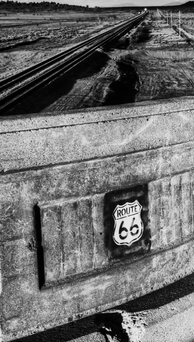 Route 66 Overpass at Crookton, Arizona.
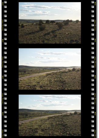
Disappointed and tired from the day’s event thus far, I decided to by-pass the Williams area entirely and try to reconnect with BNSF’s Seligman Subdivision at the subdivision’s namesake - Seligman, Arizona. Near the beautiful Ash Fork area we found an exit, Crookton Road, Exit 139, which reconnected with Route 66 and, thusly, the tracks. We had been away from the tracks at this point because in 1960, the Atchison, Topeka, & Santa Fe, part of the now BNSF, completed the Crookton-Cutoff which realigned the route between Williams Junction and Crookton, Arizona to reduce grades and curvatures in the area. The old alignment and roadbed can easily be seen from Interstate 40 which has accompanied us along our way since Williams.
Traveling west on Route 66, Crookton Road, from Interstate 40 brought us to location where the Crookton Cutoff crossed under Route 66. As we reached the overpass I slowed, as is my typical style, to look down the tracks in both directions to get see if there are any headlights on the horizon or signals which might betray a pending passing train.
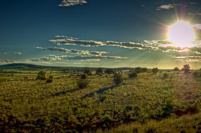
There was no indication of an immediate passing train to be seen, but, being the BNSF’s transcon route, I knew it wouldn’t be long before one was hustling by. As I looked at the trackage from the overpass I was taken by the photographic quality of the location. The left side of the overpass had trackage which curved under the overpass and was baklit by the setting sun. The right side offered a straight alignment which was partly lit by the sun and passed through a cattle range.
I initially continued on passed the location and thought better of my decision. I made a u-turn and then another to reasses the possiblitites. I made up my mind. This was where I was going to make my final stand as the sun set below the horizon.
I found a safe location removed from the passing traffic on the west side of the overpass in which to park and left the engine running so that Deb could continue her present slumber in comfort with the air conditioning running. I grabbed my camera, regretably sans tripod, and made my way back to the overpass. I guess I hadn’t plan to be there long.
As I progressed back down the road I made a few test shots to assess the lighting and possbile framing of the scene. Some cattle were grazing down the embankment and I guess the sight of my long shadow cast down upon them spooked them and they began to run away, “mooing” all the way.
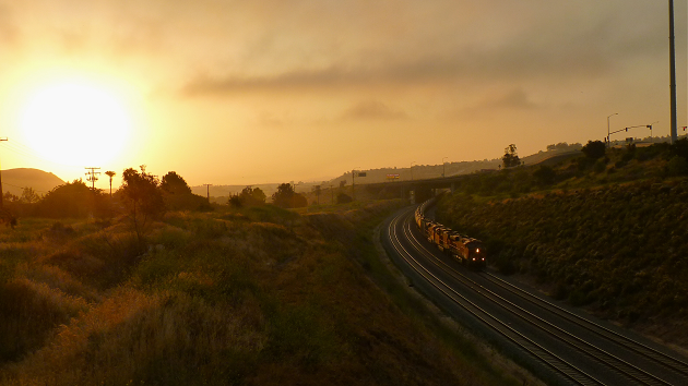
Shortly thereafter, I noticed smoke on the horizon in the west. Here comes one! I checked for traffic on the road and crossed to get into postion. It was an eastbound manifest train moving through West Crookton.
Had I thought to grab my tripod out of the truck I would have tried to capture the scene in HDR. The pace of the moving train would have presented a problem to HDR photogrphy, perhaps, but I have wanted to know what the challenges of photography moving trains in HDR would be so I could possibly figure out how to overcome the problems.
I set-up the camera for aperture-priority and closed the apeture as much as I could. These shots would be hand-held and manually framed. I fired off a series of shots as the train drew near.
Since I have begun to work with HDR photos, it is clearly apparent to me now, how cameras tend to fall short in capturing the scene as I see them. Sure is gives us an essence of what was but the subtle nuances in the details are often washed out and lose relevance in the final shot.
Don’t get me wrong, I like the shots I took and would consider them good, but they don’t do the scene complete justice, in my opinion.
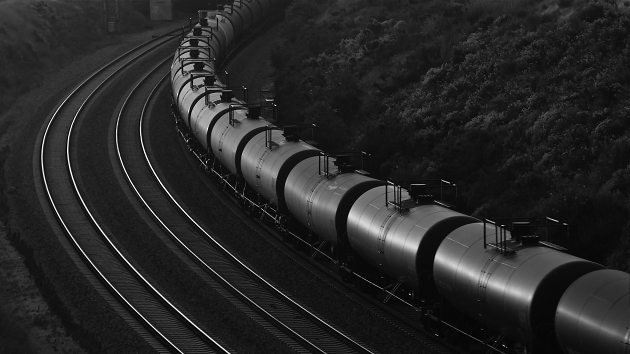
After I got home I played with the images and was able to tonemap some into psuedo-HDR images:
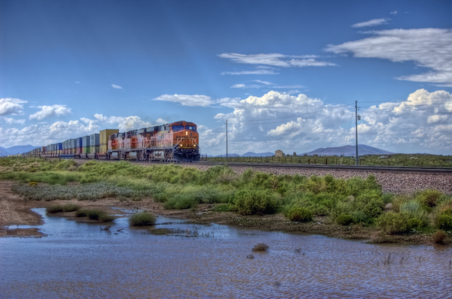
 BNSF 4782 West 1 - BNSF 4782 (GE DASH 9-44CW), BNSF 4432 (GE DASH 9-44CW), and 2 more unidentified BNSF GE DASH 9-44CWs are on the point of this eastbound manifest train passing West Crookton, Arizona on BNSF’s transcon as the sun sinks low towards the horizon.
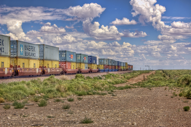
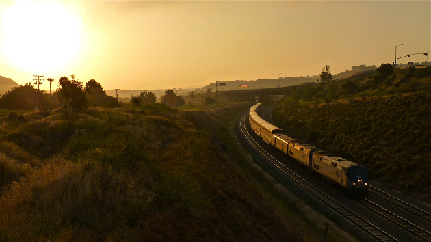
[8/11/2010 - Seligman Subdivision] © 2010 Joe Perry.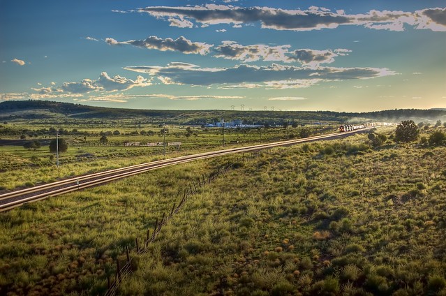 BNSF 4782 West 2 - BNSF 4782 (GE DASH 9-44CW), BNSF 4432 (GE DASH 9-44CW), and 2 more unidentified BNSF GE DASH 9-44CWs are on the point of this eastbound manifest train passing West Crookton, Arizona on BNSF’s transcon as the sun sinks low towards the horizon.
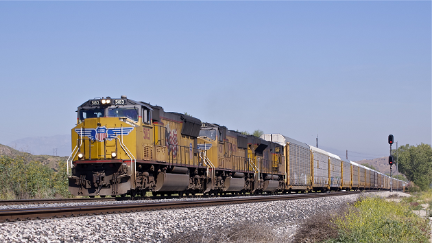
[8/11/2010 - Seligman Subdivision] © 2010 Joe Perry.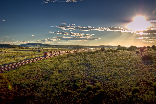 BNSF 4782 West 3 - BNSF 4782 (GE DASH 9-44CW), BNSF 4432 (GE DASH 9-44CW), and 2 more unidentified BNSF GE DASH 9-44CWs are on the point of this eastbound manifest train passing West Crookton, Arizona on BNSF’s transcon as the sun sinks low towards the horizon.
[8/11/2010 - Seligman Subdivision] © 2010 Joe Perry.
All in all I caught four trains at this location before both, the sunlight and my energy waned. I took a parting shot and thought of the fortune that had brought me here at the right time to get some cool shots despite this was not my intended shooting location.
Sometimes the railfan gods smile upon you, I guess.
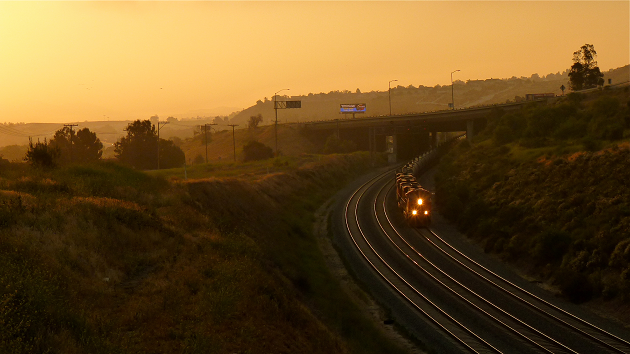
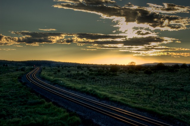 Sunset at West Crookton - The sun sinks below the horizon at West Crookton, Arizona.
[8/11/2010 - Seligman Subdivision] © 2010 Joe Perry.
 General Photography, Railroad Photography, Ramblings and Such